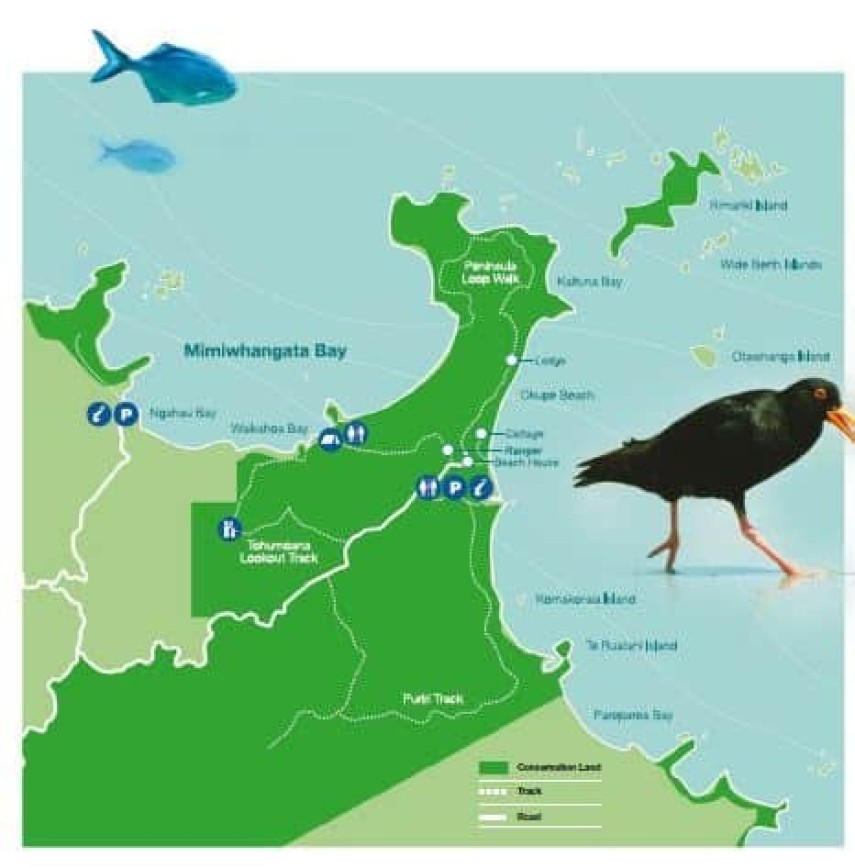
Mimiwhangata and the Importance of Regional Parks
Recently Garth made a pilgrimage to a little known regional park in Northland and below is what he recorded.
Lake Manapouri is renowned as both a place and a watershed of environmentalism. When a proposal to raise lake levels to power a hydro project was overturned by a largely urban population in the late sixties, far less known Mimiwhangata on Northlands East Coast’s groundbreaking journey to become a regional park began in the same decade.
Incredible as it may seem, back in 1962 down the dusty narrow gravel road 50 km up the east coast from Whangarei, came the directors of Lion Breweries, then one of the country’s largest companies to assume ownership of this 3000-hectare farm.
Such were the delights of the indented peninsula, sandy beaches and offshore islands that the directors hatched a bold plan to turn this exquisite piece of coastal property into a “Surfers Paradise “ type of resort with multi-storey hotels, a waterskiing lake and an outdoor aquarium. They really didn’t know much about developing such a wayward product so they employed landscape architect Harry Turbott (1930-2016) – a new type of professional who was skilled in the design of the environment.
Now once Harry had visited the site, he knew that he would be sacked on the spot if he told them that their scheme was bonkers. Harry quietly demonstrated that strategy is often the most powerful design tool. He employed specialists from Auckland University to survey and form reports on the marine ecology and archaeology of the farm. With their expertise beyond reproach, the Brewery directors were convinced of the outstanding natural richness of the site, a place that Harry believed was the exquisite overlapping of the land and the sea. Harry then worked on the most environmentally sensitive of the directors, former Air Marshall and farmer Geoffrey Roberts, and together they steered the planning towards a more natural state. By the time the Queen visited for a beach picnic in 1969 from the royal yacht anchored in the bay, plans were advancing towards a farm park. It would take another 13 years before the Breweries were enticed to swap the farm for a commercial property in central Wellington to allow the creation of a Regional Park and Marine Reserve.
Historically preserving large tracts of undeveloped land became a feature of modern landscape in the mid-nineteenth century, firstly in North America where the national parks network was established. This drive had multiple benefits that not only gave value to what was uneconomical mountainous land and provided a destination for urban-based populations but retained the frontier spirit the closeness to a scientifically separated concept of nature. The seminal influence of the 18-century romantic thinkers’, artists and writers were amplified by the transcendental philosophers, in particular, Henry Thoreau (1817-62) whose championing of the wild would live on in the US National Park service which would, in turn, influence our very own hierarchy of reserved undeveloped areas.
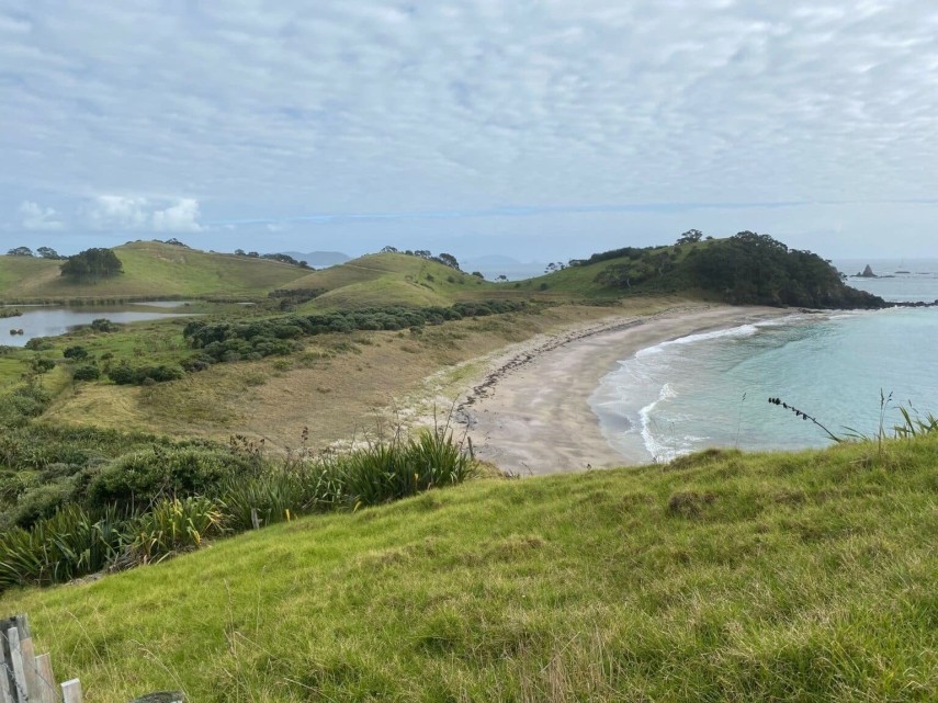
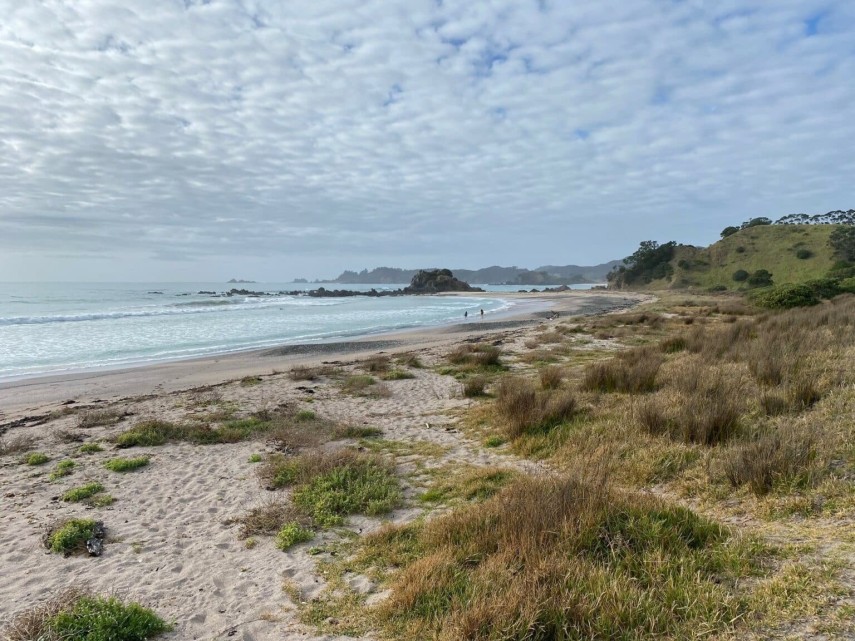
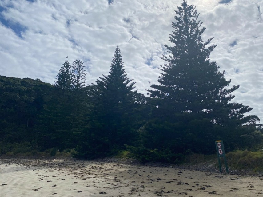
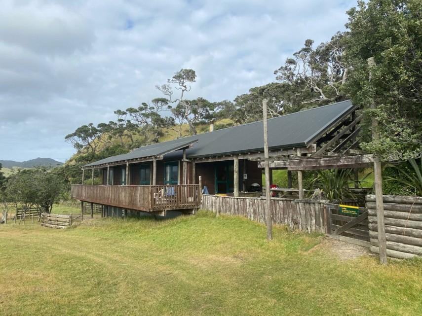
Visiting the park recently, it is painfully obvious the park has not developed in the last thirty years, it is in limbo. A lack of funding and resources means it is still largely a farm park subsisting on raising beef, renting out the 3 cottages and basic funding from DOC to keep a ranger and a couple of staff. Contractors come in once a year to take out 500 possums, but by the time they come back a year later, the same number awaits them. There is little new planting or fencing off. There are three tall 60-year-old Norfolk Pines on the foreshore as remnants of the resort dream. All that can be seen of Harry’s work is the small lodge he designed and of course, his work is there, all around in the continued presence of the wetlands, the coastline and the planted valleys.
In terms of the development of the regional parks, we only have to look at Tāwharanui on the 588 hectares of Auckland Regional Park on the Takatu peninsula to the south of Omaha. Accessed by a sealed two-lane road, enclosed by a predator-proof fence and tended to by bands of volunteers (Tāwharanui Open Sanctuary Society – akaTOSSI, formed in 2002), only 150 hectares are farmed sustainably and the rest is in the process of regeneration from nursery stock (and restocked with pukeko and kiwi) to form a mainland island. Visitors can walk across kilometres of trails, picnic, sunbathe, bbq, swim and surf and there are events such as public planting days and the staging of outdoor art and performances.
Perhaps an improved road, a predator-proof fence, a well-equipped camping ground, a biennial sculpture trail and a “friends of Mimiwhangata” restoration group could be applied to this very special part of the Northland coastline that bears witness to humanities various states of understanding.