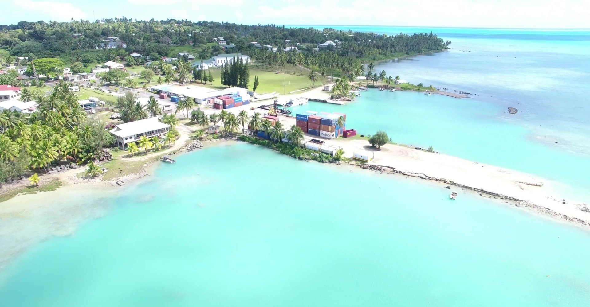
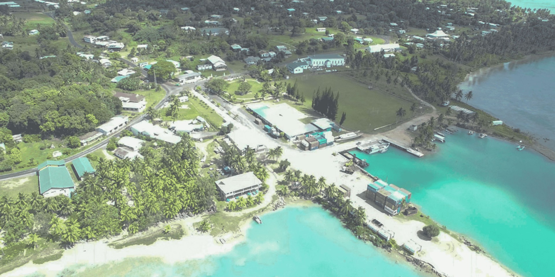
The islands of Aitutaki lie about 200 km due north of Rarotonga in the Cook Islands and have long been long celebrated as one of the jewels of the pacific. However, these seemingly pristine islands with its ringed lagoon are at a tipping point, as they have increasingly borne the burden of regional issues such as heightened demands of mass tourism, waste disposal and flight of their young people to the bright lights of New Zealand.
The island has not had any organised public planning and has little regulation of land use or development. Traditionally land is owned tribally and through families. Landowners have long resisted any form of control or regulation which has presented huge challenges to the coordination of standards and supply of facilities.
Following a successful spatial planning project of Rarotonga’s main township of Avarua, Reset Urban Design together with Romani Katoa Rarotongan based architect and project manager were engaged by Cook Islands Investment Corporation (CIIC - a wholly Cook Islands Government owned entity for managing assets and facilities) to carry out the ambitious goal of providing the first ever spatial plan for the island of Aitutaki.
The ensuing eight month process the team closely worked with the Mayor and Aitutaki Island Council (made up of elected representatives that has responsibility for the management of the island), island ward community boards, special interest groups and the general public. The Cook Islands Government and CIIC project manager Anne Taoro encouraged a strong local direction driven by Aitutakians and took a backseat role enabling local direction.
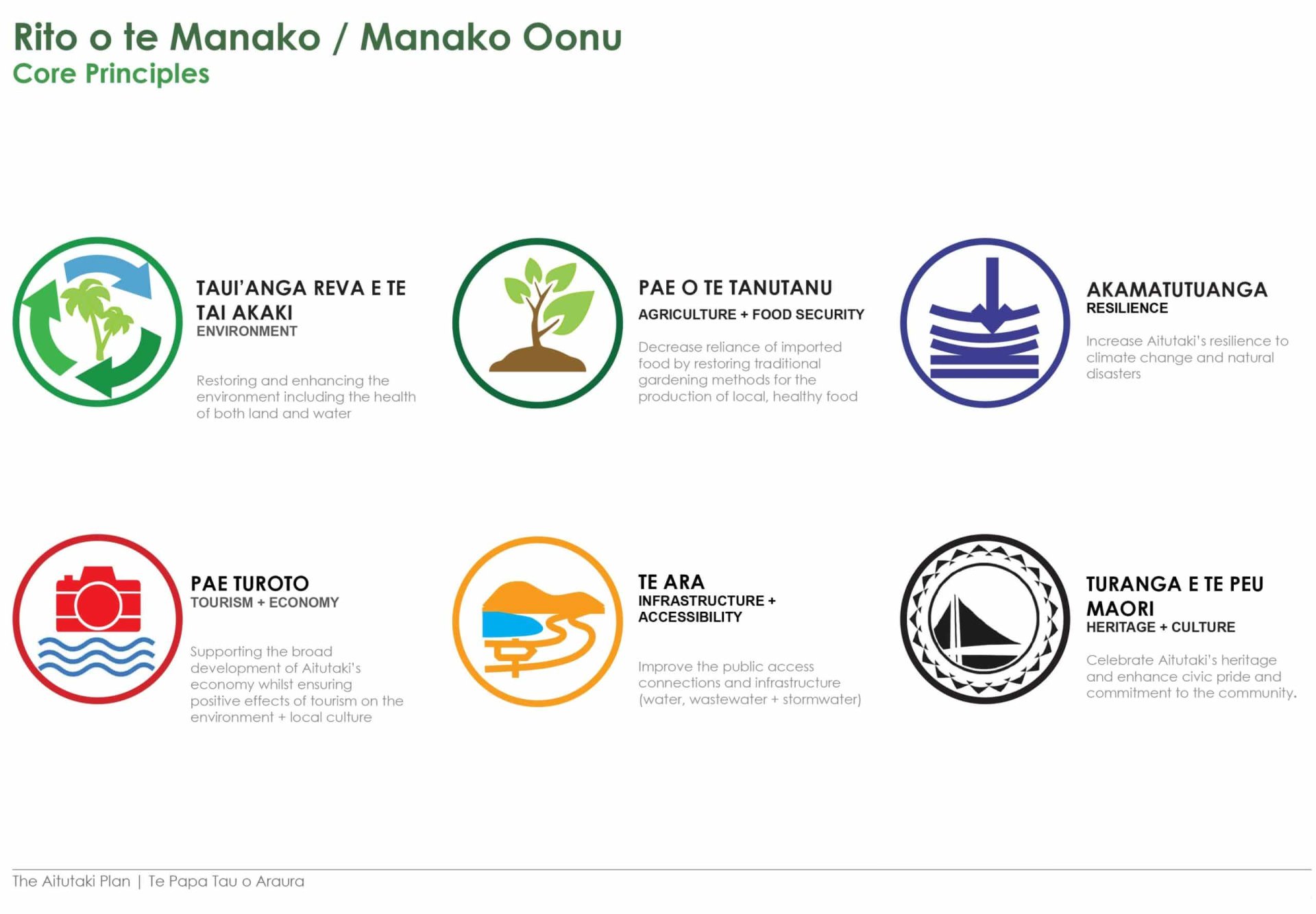
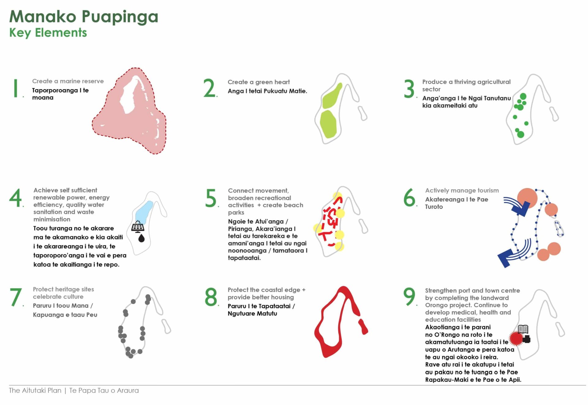
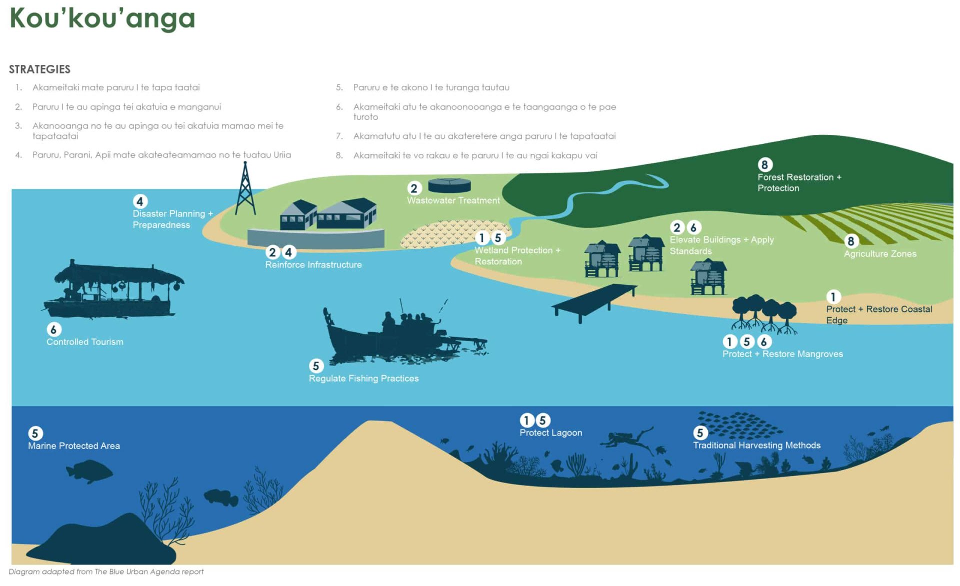
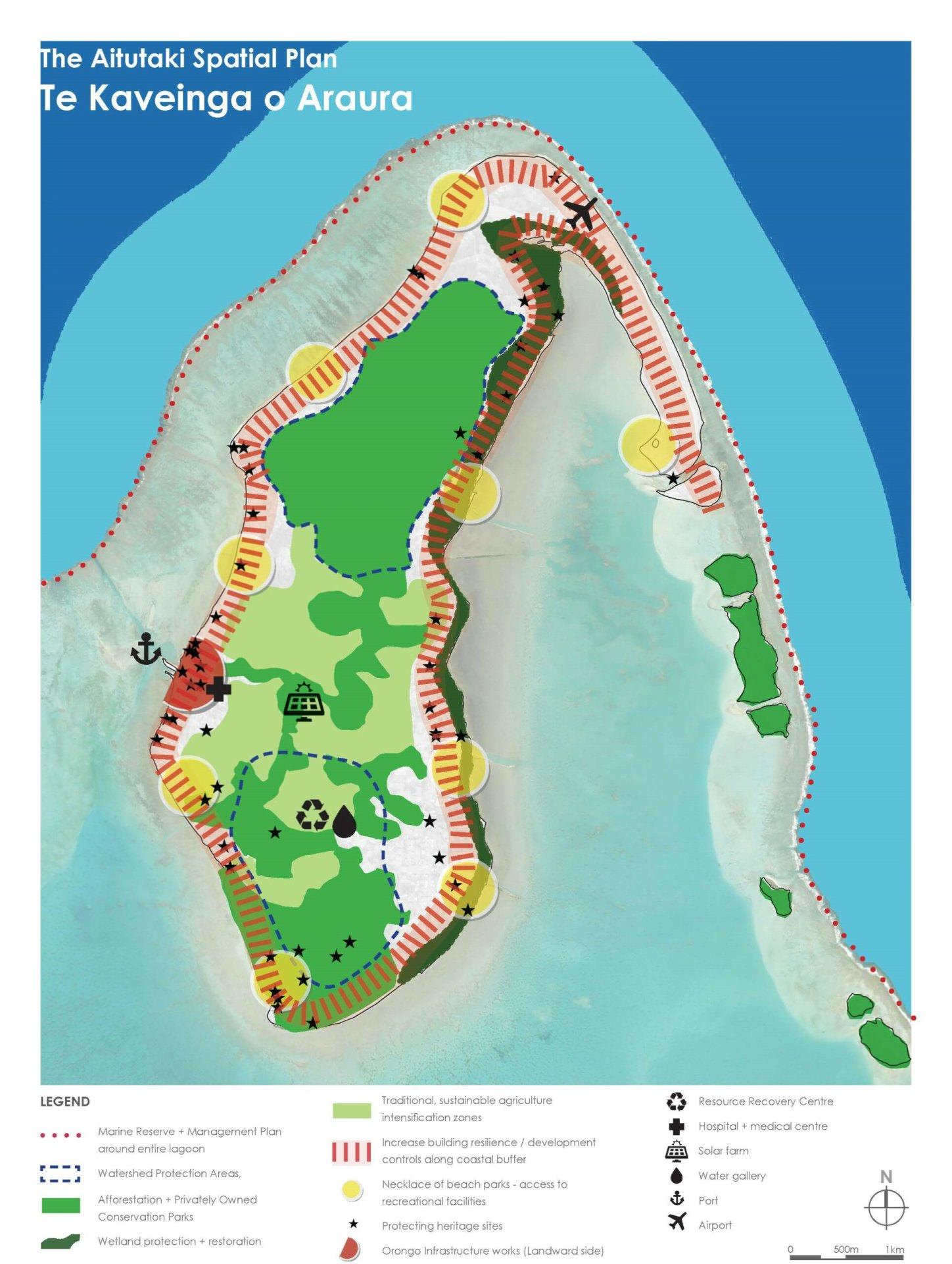
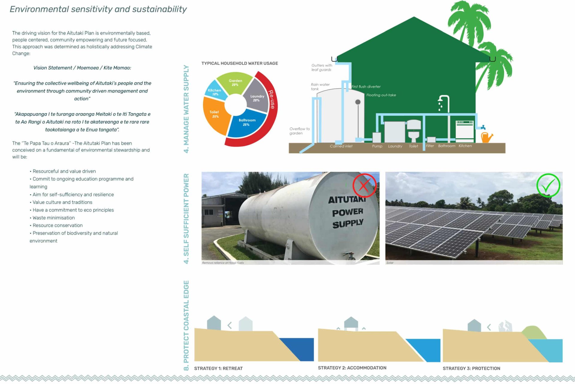
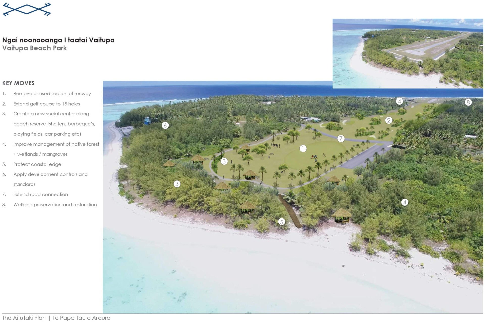
"Te Papa Tau o Araura" - The Aitutaki Plan is a much needed first step to recognise and address development and management issues across all aspects of the islands planning including land use, reafforestation, movement, open space, waste disposal, water supply, housing and even signage in an integrated and coordinated manner.
This dual language plan ( a fully translated document in Cook Island Maori was also produced) was developed during 2019 and successfully adopted by the Aitutaki Town Council and the Cook Islands Cabinet. Our teams contribution has set a staged implementation plan for the next 30 years and a benchmark for best practise locally not only in the Cook Islands but further across the Pacific Islands.
Services Masterplanning, Community and Stakeholder Engagement, Urban Design
Team Stantec
Awards International Federation of Landscape Architects AAPME Climate Crisis Design 2022 Award