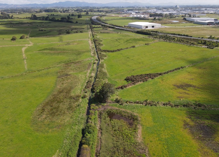
The Rotokauri Greenway is a joint stormwater management project between the Public and Private sector that enables the mainstream channel next to wetlands and water storage ponds – to help manage and improve the stormwater that reaches our waterways. The Rotokauri drain flows into Lake Rotokauri, into the Ohote Stream, the Waipa River and then to the Waikato River. The greenway will raise the quality of water that reaches the Lake.
Hamilton’s population is expected to increase to 310,000 people, with around 60,000 new homes needed over the next 50 years. The Rotokauri development area will be a key part of Hamilton's future urban growth strategy. It has a planned capacity of approximately 7,000 homes and will provide for an eventual population of between 16,000 and 20,000 people. The area of approximately 788ha will be dedicated primarily to residential use but will ultimately also provide 280ha of industrial land, employment areas, and a neighbourhood centre that will act as the principal community focal point based around a vibrant town centre.
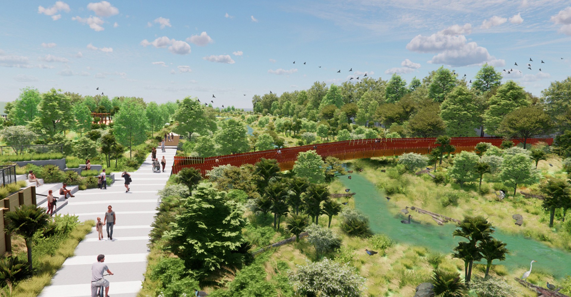
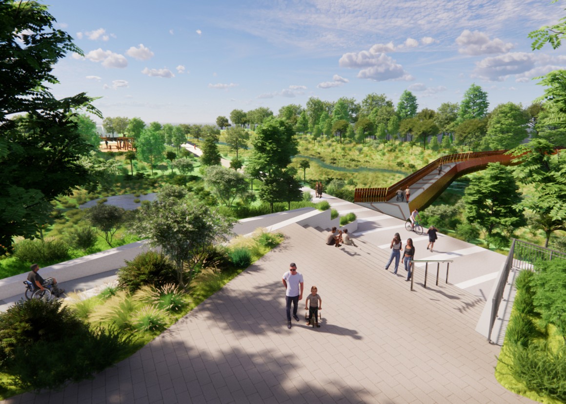
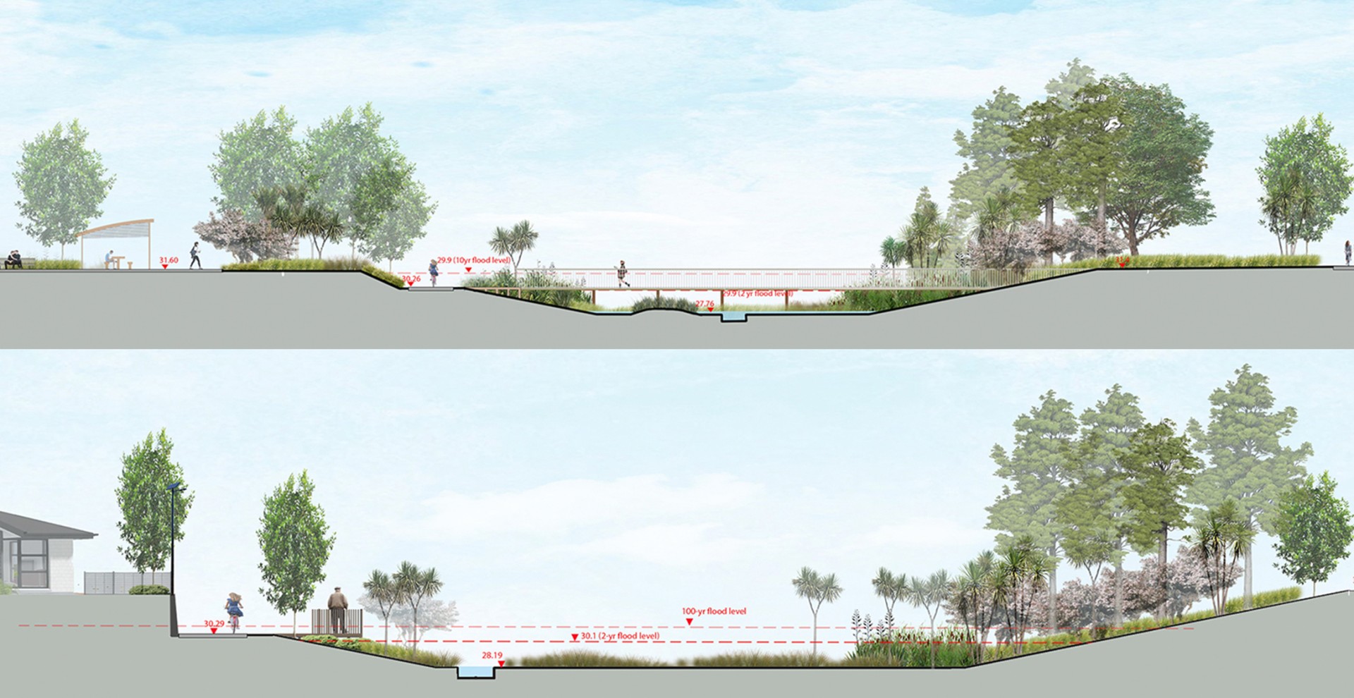
The Rotokauri Greenway will be the main public recreation and destination area for Rotokauri. It will be a celebrated blue and green landscape corridor connecting Lake Waiwhakareke to Lake Rotokauri, providing a natural recreation space, improved habitats for flora and fauna and stormwater management. This project will provide the necessary infrastructure of stormwater management and discharge along with critical roading connectivity, wastewater, power, fibre and active transport modes to enable the residential development of Rotokauri, a ‘live’ zoned residential growth cell.
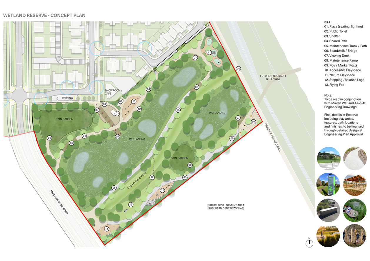
The project features:
- Over 500,000 new plants along the length of the corridor
- Over 5km of new walking and cycling pathways
- A resilient and performative landscape corridor connecting lake to lake
- A layering of interconnected systems and processes of stormwater + ecology + culture + connectivity + amenity + planting
- An experiential landscape of boardwalks, bridges, lookouts, seating, informal play, and path network
- A considered, cost-effective design that considers whole-of-life maintenance
- A landscape of variety (nodes, planting, views, ecologies, ebb and flow of water) and continuity (pathway, materials, furniture)
- Stormwater treatment train approach including a 4.7km stormwater conveyance swale, 12 artificial wetlands, rain gardens and flood storage areas
- Increased biodiversity and habitat creation (birds, bats, lizards, native fish)
- Connection to Waiwhakareke Natural Heritage Park
- Opportunity to restore and regenerate the land and reflect the culture unique to the history of this area and Hamilton Kirikiriroa
- Healing, enhancing and celebrating the whenua, the wai and the tangata
- Play-along-the-way & nature play elements
- Educational opportunities (flora & fauna)
- Large open spaces for community social gatherings and activities
Reset provided specialist urban design and landscape architectural services for this new public recreation and destination area for Rotokauri.
Services
Urban Design, Master Planning, Landscape Architecture, Landscape and Visual Effects Assessment, Detailed Design
Team
Hamilton City Council, Hounsell Holdings, Barkers & Associates, Maven, WGA NZ, HD GEO, Ecological Solutions, CKL
Website
www.hamilton.govt.nz